Property Flood Report
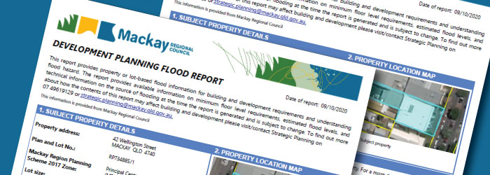
The property flood report provides property or lot-based flood information for building and development requirements and understanding flood hazard.
The report provides available information on minimum floor level requirements, estimated design flood levels, and technical information on the source of flooding at the time the report is generated and is subject to change.
An instructional video to demonstrate how to generate a property flood report is available below. Please see the frequently asked questions to assist with understanding what information council can provide and clarification of key terms applied to the property flood report.
Access the property flood report
To find out more about how the contents of this report may affect building and development please contact council on 1300 MACKAY (622 529)
For additional information on the flood studies used to inform the information provided in the property flood report please refer to council’s Flood Study page.
How to Use the Flood Report Tool
Welcome to this user guide for Mackay Regional Council’s Development Planning Flood Report Tool.
This easy-to-use tool replaces the customer or online request for Q100/Defined Flood Event/Defined Storm Tide Event & Minimum Floor Level.
Frequently Asked Questions
Can Council Advise if a Property Has Been Flooded Before?
Council does not provide property based historical flood information and do not have sufficient records to provide advice about how individual properties have been impacted by flooding in the past.
Can Council Advise if a Property Will Flood in the Future?
Council cannot predict future flooding, instead, council uses expert consultants to complete flood studies that provide flooding characteristics benchmarked against how likely those characteristics are likely to be equalled or exceeded. These benchmarks are defined using an Annual Exceedance Probability or AEP.
What is AEP?
AEP or Annual Exceedance Probability is the term used to define the likelihood of a flood and replaces the old terminology of Average Recurrence Interval (ARI).
In simple terms, a flood with a 1 per cent AEP, has a 1per cent chance of being equalled or exceeded in any one year. Alternatively, it has a 1 in 100 chance, and is equivalent to the ‘old’ 100 year ARI. Flood risk professionals have moved away from using the 100 year ARI terminology as many members of the general public interpreted this as if a flood had recently occurred, it would not happen for another 100 years. There are many examples across the country of areas being impacted by large floods multiple times in a single decade.
Are There Different Types of Flood maps?
Yes, council offers a range of flood mapping products categorized into emergency preparedness flood mapping and probability-based mapping.
Council provides evacuation maps to assist with emergency preparedness that are available through council’s Disaster Dashboard. The evacuation maps are used as a communication tool for evacuation messaging during an event. The presence of properties within a zone does not necessarily indicate that the home will be exposed to a flood hazard, however, evacuation routes may be cut off and hence those residents are grouped together. Evacuation maps are not probability based and should not be used to determine a properties flood risk, for this council has developed a range of information materials using probability-based mapping.
Probability based mapping provides flooding extents benchmarked against how likely those extents are likely to be equalled or exceeded and are defined using an Annual Exceedance Probability or AEP (see above). Probability based flood hazard information is used by council for land use planning purposed, development assessment and can be used by members of the public to understand flood risk of individual properties which are discussed below.
Can I Access Property Based Flood Risk Information?
Yes, a ‘property flood report’ can be downloaded to provide property level flood risk information for current and projected future flood risks. The property flood report can be accessed via this link. The link includes an instructional video on how to use the tool.
Does Council Provide Flood Mapping?
Yes, council has developed an online mapping tool that provides mapping services and information for a large range of applications. The mapping tool can be used to view the extents of different flood and storm tide events for areas that have been covered by a flood study.
The service can be accessed at this link. The link will ask the user to accept ‘conditions of use’. Once accepted, a map of the region will display and the user can zoom/pan into areas of interest or use the search function to locate properties of interest. To view flooding and storm-tide extents select the “flood hazard studies” within the menu to the left of the map. Tick and expand by pressing the plus button to the left of the tick as indicated by the red box in the below diagram.
You can click through each of the layers to check which flood studies or stormtide hazard areas cover your area of interest.
Please note that there are some areas where there are overlapping flood studies so it is important to check all of the study layers. For example, areas within the North Mackay Flood Study are also covered by the Pioneer Gooseponds Catchment Flood Study. In the instances where there are overlaps, both studies are applicable.
Where Can I Get More Information?
Details of flood and stormwater studies completed and planned for completion are available in this link. The page contains the most up to date and detailed information council has available, however the information presented is detailed and often technical.
My Property is Within a Mapped Flood Hazard Area but the Property Has Never Been Flooded – Why Are Council’s Maps Incorrect?
The flood and coastal hazard overlay in the Mackay Region Planning Scheme considers potential flood events that have a 0.2 per cent, or 1 in 500, chance of occurring in any one year. It is possible, and even likely, that properties captured by the overlay have not been inundated before due to the low probability of the event mapped.
Furthermore, flood studies provide a snapshot of flood hazard at certain point in time. Earthworks completed as part of new developments and some flood mitigation works completed after the study was commenced may not be represented.
It is also important to note that being outside of the flood hazard overlay does not guarantee that a property will not be flooded in the future as larger floods, with a lower probability of occurring are also possible.
Why Does Council Update Flood Mapping?
Council updates flood mapping and flood information to ensure the community has access to the most current and detailed data available. This enables residents to make informed decisions and strengthens the region’s resilience. The updates respond to recommendations from the Queensland Flood Commission of Inquiry, aiming to provide comprehensive, risk-based mapping that helps residents, professionals, and local government better understand, prepare for, and manage flood risks.
Council also anticipates future challenges such as increased rainfall intensity and sea level rises due to climate change, taking proactive measures to manage these risks effectively.
What Are the Benefits of Up-to-date Flood Mapping and Information?
Access to up-to-date flood information empowers our community and industry professionals to make informed decisions across various activities, including emergency preparedness, education, insurance, land use planning, infrastructure development, building controls, coastal management, structural works, and environmental management. Understanding flood risks helps build stronger, more resilient communities prepared to mitigate and manage flood impacts effectively.
What Are the Different Types of Flooding That Impact the Mackay Local Government Area?
There are three main categories of flooding that impact the Mackay LGA including riverine flooding, overland flow or flash flooding and coastal inundation.
Riverine Flooding
Riverine and creek flooding is caused when runoff from upstream catchments during significant rain events exceeds the channel capacity of a river or creek and overflows onto the surrounding floodplain.
The ‘Foulden Flood’ which occurred on February 18, 1958 is regarded as the largest documented flood in the region. In terms of river height at Mackay city, the event is significantly larger than any other on record.
The size of the flood was caused by heavy rainfall in the upper catchment, 34.58 inches (878mm) at Finch Hatton in the 24 hrs to 9am on February 18,1958. More than half of the regions average annual rainfall fell in one day and generated large flows in the Pioneer River and its tributaries. These f lows reached Mackay which was already saturated having received 30.74 inches (781mm) of rain in the three days leading up to the event. South Mackay was severely flooded when the river broke its banks at the Shakespeare Street/Nebo Road corner (Wright, B. 2008). However, the flood is most well-known for removing the entire settlement of Foulden, which occupied the northern bank of the Pioneer River roughly downstream of Edmund Casey Bridge. 136 people were rescued from Foulden and Cremorne, while ultimately two lives were lost to drowning and one person was declared missing (Wright, B. 2008).
Flash Flooding
Overland floods, or flash floods, occur when runoff from storms exceeds the capacity of the underground and overland drainage systems and water begins to flow over the surface of the land along natural flow paths or valleys towards the nearest creek or river. They can be localised or widespread depending on the path or extent of storm activity.
The 2008 flood is the most well-known recent example of overland and flash flooding to impact the Mackay urban area. During the event 736 mm of rainfall in less than six hours was unofficially recorded. The most intense rainfall fell over the Gooseponds Creek catchment with severe riverine flooding from Gooseponds Creek impacting the suburb of Valetta Gardens. Less severe flash flooding was widespread over Mackay urban areas. While no lives were lost, more than 4,000 houses were flood damaged, contributing to a total estimated insured loss of $410 Million (Historical Disaster Statistics, ICOA).
Coastal Inundation
Coastal inundation during storm surges occurs through a combination of low barometric pressure, strong winds and large waves raising the level of the ocean and forcing waters onto coastal areas.
The storm surge of 1918 remains widely regarded as the most significant natural disaster in the region's history, claiming 22 lives and causing hundreds of injuries whilst destroying approximately 75% of the building stock in Mackay (Wright, B. 2008). The event was caused by the coincidence of heavy rainfall, 55 inches (1397 mm) in 3.5 days, with an intense tropical cyclone crossing the coast causing a storm surge of approximately 3.7 m combined with tide to produce a storm tide level of approximately 5.4 m AHD. The impacts of the event were exacerbated by extreme winds and the lower engineering and building standards of the time.
Does Council Provide Flood Mapping to Insurance Companies?
For insurance purposes, the standard definition of flooding is
‘The covering of normally dry land by water that has escaped or been released from the normal confines of:
- any lake, or any river, creek or other natural watercourse, whether or not altered or modified; or
- any reservoir, canal, or dam.’
Council shares riverine flood information with the Insurance Council of Australia, ensuring insurers access reliable flood information to set accurate premiums.
This collaboration promotes competitive pricing and helps property owners make informed insurance decisions based on their flood risk exposure.
Will Flood Mapping Affect My Insurance Premiums?
Flood mapping informs insurance premiums by providing detailed property-specific flood risk data. While flood information may influence premiums, it also aids in managing flood risks effectively, potentially reducing insurance costs through improved risk assessment and mitigation efforts.
Will Flood Mapping Affect My Property Values?
Flood mapping is one factor influencing property values, although its specific impact can vary. Council’s updated flood mapping ensures residents, professionals, and local governments have essential risk-based data to understand, prepare for, and manage flood risks effectively.